(Click on named locations for more information)
![]()
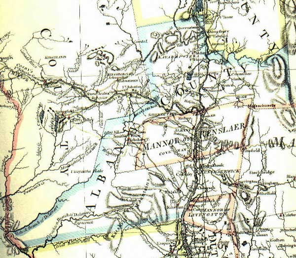
Often called the Sauthier Map, its official title is "A Map of the Province of New York, Reduced from the large Drawing of that Province, compiled from Actual Surveys by Order of His Excellency William Tryon Esq. Captain General & Governor of the same, By Claude Joseph Sauthier, to which is added New Jersey, from the Topographical Observations of C. J. Sauthier & B. Ratzer." Engraved by William Faden and published in London in 1776. The image map shown above represents old Albany County and is taken from a larger and more expansive print. Inexpensive copies of this colorful representation are widely available!
Claude Joseph Sauthier (1736-1802) was an Alsace-born cartographer who made maps for the British army. Trained in architecture and as an illustrator, he followed Tryon to North Carolina in 1767 and then to New York in 1771. He produced a number of spin-off maps of the New York region.
first posted 7/10/03; last updated 2/4/19