|
State Surveyor-General and Albany resident Simeon De Witt made a number of maps for the Albany corporation during the early 1790s. The first of these is preserved in the collection of the Albany County Hall of Records. The original is faded, only faintly readable, and not suitable for presentation. The versions most often seen are reprints of engravings made in 1794 and after. Two of these engravings are of particular value in understanding the layout and development of the post-Revolutionary city. Presented directly below is a reprint of an engraving of a map we believe was made by De Witt about 1790. It was his base (or basic) city map. It seems to represent Albany's existing features at that time - depicting functional streets, natural features, public buildings, and other landmarks. With the maps made by Wolfgang Roemer and Robert Yates, it is of inestimable value. 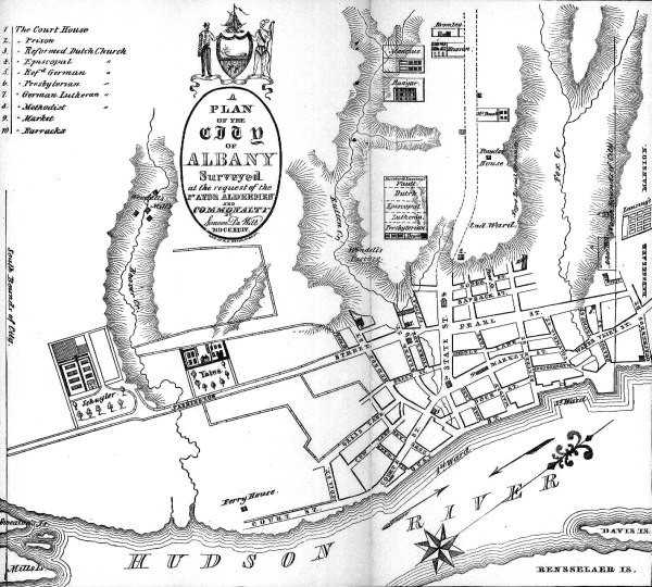
A "few" years later, De Witt produced another version of his city map. It was based on his earlier cartography, chronicled some of the changes (particularly along the waterfront) in the Albany landscape since his earlier work, marked political subdivisions (wards), and included blocks of speculative streets that had not yet been laid out. The city today is based on this street plan. The image presented below is a copy of an engraved version of that map. 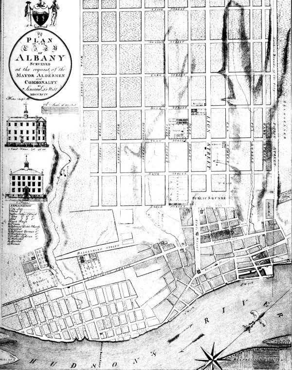
Although they depict the city at the end of its formative period, these historical icons have been widely used in virtually every exposition on the history of early Albany.
The first likeness of the De Witt map of 1790 is taken from an engraving by W. H. Pease as it appeared in Arthur J. Weise, The History of the City of Albany, New York (Albany, 1884). At this point, we have not a manuscript version of this basic city map in any publication. The representation shown directly above is taken from an engraving made by Albany silversmith Isaac Hutton in 1794. Entitled "Plan of the City of Albany Surveyed by Simeon De Witt," it is best preserved locally in the collections of the Albany Institute of History and Art. Inexpensive offprint copies were produced in 1968 by "Historic Urban Plans" of Ithaca, New York and are widely available today in the Albany area.
posted 10/18/06; last updated 1/20/16 |