Image Map of Albany in 1794
(Scroll around and click on any feature)


click anywhere for community features
city boundary line city boundary line Castle Island City Hall new Prison ward boundaries Schuyler Mansion De Witt Map of 1794 Simeon De Witt - cartographer the Beaverkill Yates Mansion the Beaverkill the Beaverkill Lion Street or the Kings Highway The Public Square Lion Street or the Kings Highway Lion Street or the Kings Highway Samuel Bromley's inn at Lion and Dove new Prison The Masonic Lodge first Municipal Cemetery Schuyler House Elm Tree Corner - or Webster's Corner St. Peter's Barracks or Chapel Street Barracks or Chapel Street First Ward Second Ward Third Ward Dutch reformed Church City Hall Market House Washington Street - now South Pearl Washington Street - now South Pearl Hallenbeck Street the Pastures the Pastures Lydius Street - now Madison Avenue the Ferry house 'The Negro Burial Ground' Foxes Creek Jellis De Garmo lots - 1767 Foxes Creek Upper Foxes Creek Old Arbor Hill German Reformed Church Ruby's Alley city boundray line city boundray line Watevliet part of Rensselaerswyck Lansing property Watevliet part of Rensselaerswyck Quackenbush House Old Hospital Municipal Cemetery Wendell's Mills the Ruttenkill the Ruttenkill the Ruttenkill Presbyterian Meeting House Methodist Church Lutheran Church State Street State Street Lower State Street North End of Albany


You might enjoy this plaque-based tour of downtown Albany's historic landmarks.

biography in-progress


notes

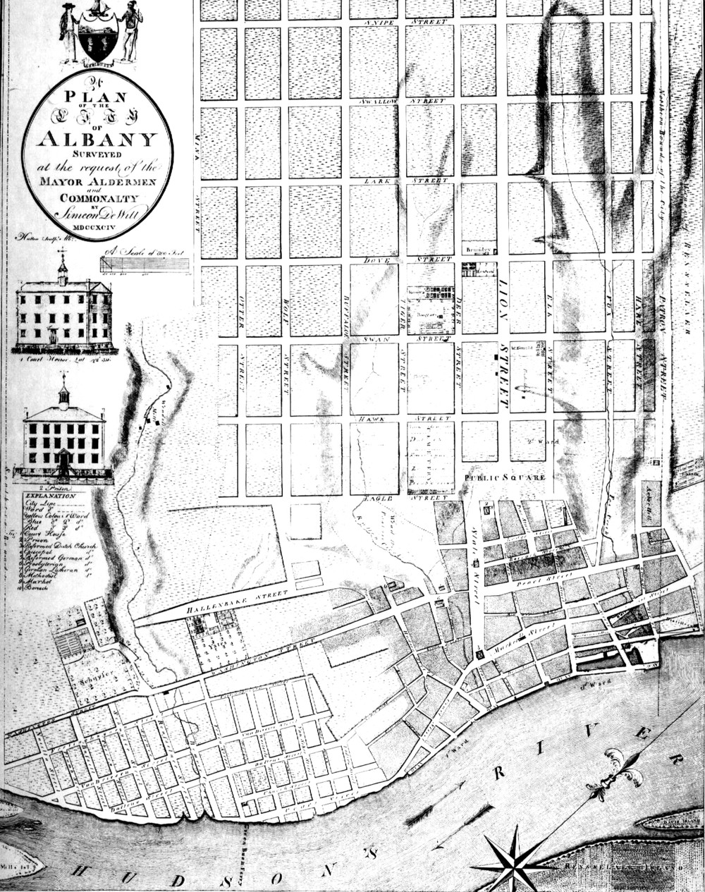
This magnificant piece of cartography represents an almost perfect visualization of the Albany setting at the end of its formative era. This image map intends to provide links to all the relevant features that were on the landscape at the end of its eighteenth century. Please use Internet Explorer as Netscape works so poorly.

Home | Site Index | Navigation | Email | New York State Museum


first posted: 7/10/03; updated 10/24/10